2D LiDAR Mobility
2D LiDAR Mobility is one of the most common configurations for indoor autonomous mobile robots (AMR).
It uses a 2D laser scanner to perform mapping, localization, and navigation in structured environments such as warehouses, offices, and factories.
This section focuses on the system architecture and core capabilities, and connects to hands-on demos provided in the Robotic Suite.
1. System Overview
A typical 2D LiDAR-based robot includes:
- Sensor: 2D LiDAR
- Perception: SLAM & Localization
- Planning: Path planning (Nav2)
- Action: Robot base control
This corresponds to the robotics pipeline:
- /scan → /map → /plan → /cmd_vel
2. Key Capabilities
-
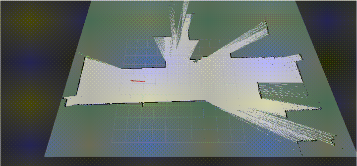
Mapping (2D SLAM)
Build an occupancy grid map of the environment -
Localization
Estimate robot pose within a known map (e.g., AMCL) -
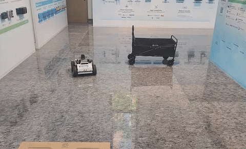
Obstacle Avoidance
Detect and avoid obstacles in real time -
Autonomous Navigation
Navigate from start to goal using Nav2
3. Demo & Sample Code
To help you get started quickly, the Robotic Suite provides pre-built demo applications and sample code for 2D LiDAR mobility.
Available Samples
- 3.1 2D Mapping with LiDAR
Demonstrates SLAM-based mapping using recorded sensor data
- 3.2 2D LiDAR Navigation
Demonstrates localization, path planning, and obstacle avoidance using Nav2

These samples are all packaged in containers to enable rapid evaluation and learning.
👉 Please refer to the corresponding sample code pages for:
- Step-by-step setup instructions
- Launch commands
- Code structure and customization
4. Use Cases
- Warehouse AMR
- Indoor delivery robots
- Service robots
5. Limitations
- Limited to 2D perception (no height information)
- Sensitive to reflective surfaces (e.g., glass)
- Not suitable for complex 3D environments
2D LiDAR Mobility provides a stable and practical entry point for building autonomous robots.